Lake Cahuilla
6 mi south · Bureau of Reclamation
Surronded by the stark beauty of the Santa Rosa Mountains, Lake Cahuilla (pronounced Kah-wee-ah) is a favorite recreation area in the Coachella Valley.
Outdoors
National forests, parks, lakes and recreation areas with hiking trails near Indian Wells, closest first.
Good to know: Carry more water than you think you need, check the managing agency’s page for trail closures and fire restrictions, and start early on hot days.
6 mi south · Bureau of Reclamation
Surronded by the stark beauty of the Santa Rosa Mountains, Lake Cahuilla (pronounced Kah-wee-ah) is a favorite recreation area in the Coachella Valley.
13 mi southeast · Bureau of Land Management
The terrain within the Santa Rosa Mountains Wilderness is rugged with elevations rising dramatically from just above sea level to 7,000 feet.
20 mi east · Bureau of Land Management
The Mecca Hills Wilderness now contains a total of 26,242 acres and is managed by the BLM's Palm Springs-South Coast Field Office . All of the Wilderness is in the state of California.
Map of 33 places loads as you scroll.
Surronded by the stark beauty of the Santa Rosa Mountains, Lake Cahuilla (pronounced Kah-wee-ah) is a favorite recreation area in the Coachella Valley.
The terrain within the Santa Rosa Mountains Wilderness is rugged with elevations rising dramatically from just above sea level to 7,000 feet.
The Mecca Hills Wilderness now contains a total of 26,242 acres and is managed by the BLM's Palm Springs-South Coast Field Office . All of the Wilderness is in the state of California.
Download the NPS app prior to visiting the park – trail maps and more! Ryan Campground lies amid the huge, steep rock formations for which Joshua Tree National Park is known.
Download the NPS app prior to visiting the park – trail maps and more! Sheep Pass Group Campground is centrally located within Joshua Tree National Park in Southern California and is easily accessible to hiking trails and rock climbing…
Download the NPS app prior to visiting the park – trail maps and more! Jumbo Rocks Campground lies amid the huge, steep rock formations for which Joshua Tree National Park is known.
Download the NPS app prior to visiting the park – trail maps and more! Black Rock Campground lies among one of the thickest Joshua tree forests in Joshua Tree National Park.
Download the NPS app prior to visiting the park – trail maps and more! Black Rock Horse Campground is strictly for campers planning to bring horses or mules .
The picturesque Fern Basin Campground is a perfect escape from a busy lifestyle. It provides peace and quiet in the mountains of southern California as well as access to countless recreational opportunities.
The Marion Mountain Campground offers a beautiful retreat in the San Bernardino National Forest. It provides access to a number of hiking trails that lead to some of the most spectacular views of Southern California.
The western boundary of the Orocopia Mountains Wilderness is contiguous with the Mecca Hills Wilderness with the exception of the Meccacopia Jeep Trail, which bisects the two wilderness areas.
Black Mountain Road is is poor condition at this time. 4 Wheel Drive is recommended. The road is currently a high-priority for maintenance, which should be occuring in June, 2023.
Big Morongo Canyon Preserve/ACEC is well recognized as an important wildlife corridor that links BLM's San Gorgonio Wilderness with the San Bernardino National Forest and Joshua Tree National Park.
Black Mountain Road is is poor condition at this time. A four-wheel drive (4WD) vehicle is recommended with a minimum ground clearance of 6 inches. Drive at your own risk.
Download the NPS app prior to visiting the park – trail maps and more! Indian Cove Campground lies amid the huge, steep rock formations for which Joshua Tree National Park is known.
Download the NPS app prior to visiting the park – trail maps and more! Cottonwood Campground is one of the best places in Joshua Tree National Park for stargazing and wildflower viewing.
Download the NPS app prior to visiting the park – trail maps and more! Cottonwood Group Campground is one of the best places in Joshua Tree National Park for stargazing and wildflower viewing.
Download the NPS app prior to visiting the park – trail maps and more! Indian Cove Campground lies amid the huge, steep rock formations for which Joshua Tree National Park is known.
The Beauty Mountain Wilderness encompasses a total of 15,627 acres and is managed by the BLM's Palm Springs-South Coast Field Office .
Two distinct desert ecosystems, the Mojave and the Colorado, come together in Joshua Tree National Park. A fascinating variety of plants and animals make their homes in a land sculpted by strong winds and occasional torrents of rain.
This wilderness is part of the eastern slope of the San Bernardino Mountains with topography rapidly changing from low, rolling foothills and canyons to steep, rugged mountains. Elevations range from 2,300 to 5,500 feet.
Remember your OUTDOOR ETHICS when enjoying your public lands. Please RECREATE RESPONSIBLY.
This oasis with its hundreds of swaying fan palms offers sanctuary in the midst of the dry Colorado Desert. Pools fed by artesian springs and seepage from the nearby Coachella Canal form a lush wetland area.
17 sites. Pacific Crest Trail Access. No Water. The nearest water can be found at the Warner Springs Gas Station.
The Pinto Mountains Wilderness is located on Bureau of Land Management lands on the Joshua Tree National Park's northern boundary.
The north-central portion of this Wilderness area holds the rugged Bighorn Mountains and the eastern foothills of the San Bernardino Mountains.
The Fish Creek Mountains Wilderness now contains a total of 21,388 acres and is managed by the Bureau of Land Management. All of the Wilderness is in the state of California.
The Juan Bautista de Anza National Historic Trail covers over 1200 miles through the homelands of 70+ Tribal communities. It follows the historic route of the 1775-76 Spanish colonizing expedition from Sonora, Mexico to San Francisco, CA.
The Sonny Bono Salton Sea National Wildlife Refuge is located in California’s Imperial Valley, 40 miles north of the Mexican border, along the southern end of the Salton Sea.
The Chuckwalla Mountains Wilderness now contains a total of 112,326 acres and is managed by the BLM's Palm Springs-South Coast Field Office . All of the Wilderness is in the state of California.
Click here for the latest information concerning upcoming military training and closures of the Shared Use Area. Overview Johnson Valley is a varied landscape for the off-highway vehicle driver.
Distances are straight-line miles from downtown Indian Wells. Listings come from Recreation.gov’s federal recreation database; check each official page for hours, fees, fire restrictions and closures before you go.
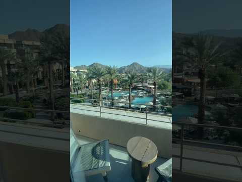
THINGS TO DO · YOUTUBE SHORT
A local activity Short shared by Nivan Stklare.
Watch on YouTube ↗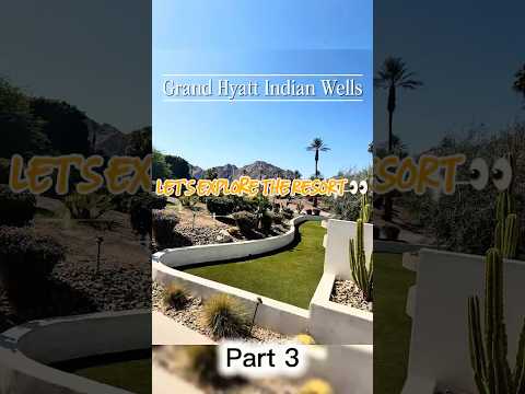
THINGS TO DO · YOUTUBE SHORT
A local activity Short shared by Stay Moving With a Purpose.
Watch on YouTube ↗

Lake Cahuilla (Bureau of Reclamation), about 6 miles south of Indian Wells as the crow flies. Next are Santa Rosa Wilderness (13 mi) and Mecca Hills Wilderness (20 mi).
Based on Indian Wells’s average highs, November–March. Conditions at higher elevations can be much cooler.
Federal agencies including Bureau of Land Management, National Park Service, USDA Forest Service. Each listing links to its official page for hours, fees, closures and current conditions.